Welcome to the O|Zone Government Authority
The O|Zone™ Government Authority is a county-established, independently governed entity designed to transform how land is acquired, activated, and stewarded for long-term community value.
Inspired by international port governance models and tailored to U.S. municipal frameworks, this Authority serves as the legal, operational, and digital custodian for land-based innovation within the O|Zone™ Initiative.
From rural regeneration to urban revitalization, it catalyzes investment through purpose-driven land conversion, AI-assisted due diligence, and distributed economic zones—all while preserving public oversight and tax-exempt financing eligibility.
Whether you are a private-sector developer, a philanthropic land donor, or a county planner, the O|Zone Government Authority offers a transparent, future-ready framework for turning land into legacy.
I. Purpose & Legal Formation
O|Zone Government Authority serves as the foundational geographic entity within a county’s O|Zone™ implementation. Functioning in part as a Land Bank, this Authority is designed to identify, acquire, hold, and manage parcels of land designated for innovation, infrastructure, and economic development under the O|Zone framework.
Its primary role is to provide legal, structural, and operational stewardship for designated O|Zone parcels, sites, and pads, ensuring alignment with the broader goals of community revitalization and sustainable investment.
Counties may establish this Authority under existing state statutes governing the formation of special purpose entities, development authorities, or trust authorities.
While historically Port Authority legislation served this function in some jurisdictions, many states now rely on broader enabling statutes that allow counties to form governmental units with site-specific authority and economic development mandates. The O|Zone Government Authority fits squarely within that legal tradition.
Each Authority is established as an independent entity, with its own board of directors and governance procedures. It is not a department of the county but rather an arm’s-length public structure operating under county oversight. This independence helps preserve eligibility for federal and state tax-exempt financing, and ensures compliance with IRS rules governing leasebacks, revenue bonds, and private activity participation.
Unlike traditional land banks, the O|Zone Government Authority does not operate solely to dispose of abandoned or surplus property. Instead, it functions as a strategic development platform, enabling counties to assemble, designate, and develop land for specific purposes—while working in concert with Master Concessionaires, Sub-Concessionaires, and other public and private entities as permitted under applicable law.
Each Government Authority adopting the O|Zone™ Protocol operates independently, and its formation does not establish a controlling relationship with other Government Authorities. Instead, any Government Authority formed under the O|Zone framework may elect to join a Port Authority Opportunity Zone (PAOZ) through the standard Intergovernmental Cooperation Agreement—a modular mechanism that allows multiple Authorities to collaborate on shared infrastructure goals while preserving their legal and financial separateness.
Importantly, a county’s eligibility to participate in a PAOZ is already recognized by virtue of the federal Opportunity Zone designation. Therefore, each Authority that satisfies O|Zone qualifying conditions may be included within the PAOZ, without requiring any one Authority to serve as an “anchor” or gateway for any other.
O|Zone Government Authority, functioning in part as the county’s Land Bank, is structured as a port-type governmental authority based on internationally recognized best practices—especially the UN “landlord port” governance model. This model provides clear separation between public-sector policy and private-sector operations, ensuring transparency, legal compliance, and operational efficiency.
The Government Authority (Policy & Oversight Role)
Establishes rules of participation, development standards, and long-term leasing and tariff terms for designated O|Zone™ sites.
Maintains legal ownership and applicable lease rights of all lands, easements, and rights-of-way under the O|Zone™ Initiative.
Governs through a 5-member Board appointed by county officials. The Authority operates independently under county law but outside of day-to-day political influence.
Issues Digital Medallions, defines eligibility criteria for operators, and enforces compliance with county-adopted O|Zone™ objectives.
May enter into MOUs with other Government Authorities, both within and across counties, to support collaborative infrastructure, development, and regulatory efforts.
Master Concessionaire & Sub-Concessionaire Roles
To blend international governance standards with U.S. municipal bond rules, the Authority adopts the UN landlord port model, which divides responsibilities as follows:
The Government Authority sets policy, oversees compliance, and retains all public ownership.
A Master Concessionaire is appointed by the Authority to administer daily operations under a detailed service agreement.
Sub-Concessionaires are private operators that lease or license parts of the site (the “O|Zone pad”) and deliver goods and services within defined frameworks and tariffs.
UN Landlord Port Model – Global Standard
Under guidance from the UN Conference on Trade and Development (UNCTAD) and the World Bank, this model:
Keeps public ownership of physical infrastructure and regulatory oversight.
Delegates administration to a limited-purpose operator (Master Concessionaire) who acts on behalf of the public authority, not for its own profit.
Enables diverse for-profit sub-concessions to operate under standardized rules and tariffs.
Enhances accountability via public boards and private–public coordination.
Used globally—from Rotterdam to Singapore to New York/New Jersey—this model ensures scalable development and public–private alignment.
U.S. IRS Compliance – Tax-Exempt Bond Treatment
To maintain tax-exempt bond eligibility, the Master Concessionaire structure must follow IRS Revenue Procedure 2017-13, including:
No sharing in net profits of the Authority;
Fixed-fee or unit-based compensation, not tied to site revenues;
Purely administrative operations—not a revenue participant;
Authority retains core rights (budget, staff, strategic direction);
Term-limited contracts, maximum, lesser of 30 years or 80% of the expected useful life of the managed facility or capital asset.
This protects against “private business use” violations and preserves the Authority’s ability to issue tax-exempt municipal bonds.
Sub-Concessionaires – Private Sector Activation
Unlike the Master Concessionaire, Sub-Concessionaires are fully private enterprises that:
Use rights within O|Zone sites and pads;
Pay tariffs or fees to the Authority;
Comply with all zoning, safety, and policy rules;
Drive innovation, jobs, and investment across sectors.
Examples:
A medical operator deploying a ScanPort™ Pod;
An energy company installing on a GreenBox™ energy platform;
A culinary artisan running a farm-to-table kitchen or school.
These firms operate under a transparent, enforceable tariff schedule adopted by the Government Authority.
Intergovernmental Integration & PAOZ Membership
The Authority is designed to interoperate locally and regionally:
Any O|Zone-compliant Government Authority can join a Port Authority Opportunity Zone (PAOZ) through an Intergovernmental Cooperation Agreement in their designated Economic Development District.
The PAOZ is a coordinating framework, not a separate legal entity.
Member Authorities align tariffs, revenue-sharing, and operations while retaining full local control.
A portion of Authority revenues may fund shared services, including a regional Executive Director, staff and oversight board selected by participating members.
The Authority may also participate in the national O|Zone Initiative (USA), a 501(c)(4) that promotes awareness, technical support, and national standards for O|Zone implementation.
Digital Land Library – AI Mapping and County Intelligence Framework
O|Zone™ Government Authority serves not only as the legal custodian of designated sites and pads—it also acts as the county’s anchor for long-term digital transformation of land intelligence.
To support this, the Authority may establish a Digital Land Library, a modern AI-assisted archival and analytic system that aggregates historical, legal, geographic, and environmental data tied to all land within the county.
Mission: Holistic, Intelligent Stewardship of County Land
While traditional land banks begin with foreclosed or distressed parcels, the O|Zone™ Government Authority begins with zero land and instead initiates a countywide effort to understand land before acquiring it. The Library enables the Authority to serve as a digital librarian of the full landscape—mapping the legal, physical, and economic characteristics of parcels over time. It empowers site planning, environmental diligence, AI-supported zoning interpretation, and future site selection.
Consolidating Fragmented Records
Across most counties, historical records are siloed, incomplete, or undigitized. Many small towns and rural jurisdictions hold massive archives—municipal codes, easements, water flow paths, zoning ordinances, title records—that have never been scanned, tagged, or connected.
The Digital Land Library provides a platform to:
Digitize and vectorize historical land documents, mineral rights, and county code archives;
Consolidate scattered data from assessors, clerks, registrars, and code enforcement offices;
Map drainage, aquifer, and pollution histories that may intersect with public health;
Track chain-of-title histories and legacy easement claims across parcels.
Private Sector Sub-Concessionaires
Under the UN landlord model, the Authority may engage Sub-Concessionaires to operate components of the Library.
Examples include:
Title companies, which already maintain deep archives of parcel histories and abstract chains;
Surveyors and civil engineers, who can geo-reference old paper maps and plats;
Environmental firms, who may track EPA enforcement zones or chemical exposure corridors;
Historic preservation groups, tribal land councils, and academic partners.
These actors become active contributors to a shared AI land knowledge framework—earning participation via data licensing, service fees, or tariff-linked compensation.
AI-Powered Forensic History & Risk Flagging
The Digital Land Library is not a static archive.
Once legacy data is ingested and vectorized, AI models can:
Detect unknown easements, expired conditions, or silent title defects;
Analyze patterns in zoning changes, title claims, or utility expansions;
Recommend best-fit locations for future pod deployment or site conversion;
Provide SmartSite AI feedback to prospective buyers, lessees, or county planners.
Funded Through Digital Tariff Revenues
This AI-driven platform is supported via a portion of tariffs collected from Sub-Concessionaires and site operations across the O|Zone™ ecosystem. It aligns with the Authority’s broader objective of using digital infrastructure to fuel physical development, and creates a self-reinforcing mechanism for transparency, site optimization, and economic growth.
Land Inputs & Site Acquisition Strategy
O|Zone™ Government Authority begins with no land of its own.
Its power lies not in holding land for its own sake, but in enabling the intelligent transformation of underutilized parcels into O|Zone Sites—each designated and qualified to support catalytic economic and community activities.
Land May Be Acquired Through:
• Transfer from County or Municipal Entities
Parcels held by the county or local governments—including surplus land, underutilized rural holdings, or legacy properties—may be designated as O|Zone Sites and conveyed to the Authority via board-approved action.
• Gifts, Bequests, or Estate Planning Transfers
Individuals or families may gift land to the Authority as part of philanthropic legacies or tax-efficient estate transitions. The Authority may work with attorneys and fiduciaries to structure these transfers.
• Voluntary Sales
The Authority may acquire land through arms-length purchases or option contracts—often in collaboration with private-sector operators or under a larger O|Zone Site plan.
• Judicial or Tax Foreclosures
While not the core strategy, parcels entering county control through legal actions may be considered for O|Zone designation and reuse—subject to environmental and title diligence.
• Private Sector Donation or Discount Sale
Developers or corporations holding stranded land assets may seek to convey them into the O|Zone program in exchange for tariff recognition, Digital Medallion participation, or other programmatic value.
Pre-Acquisition Due Diligence
Every parcel under consideration—whether gifted, transferred, or purchased—must undergo a rigorous intake review facilitated by the Digital Land Library.
This includes:
• Chain of Title Review – Verifying legal ownership and history of transfers, easements, restrictions, and mineral rights separations.
• Environmental Review – Identifying contamination risks, prior industrial uses, buried tanks or piping, and past EPA or DEQ findings.
• Zoning & Access Assessment – Confirming legal access, adjacency to rights-of-way, and compatibility with targeted O|Zone functions.
• Structural Risk Analysis – Reviewing floodplain overlays, drainage issues, or other physical features that may impair site viability.
The Authority is not a passive landholder. It must treat all inbound land as potentially carrying historical liabilities—legal, financial, or environmental.
Protective Structures for Intake
To prevent the contamination of the Authority’s broader asset base, parcels with questionable histories may be accepted through:
• Ring-Fenced Series LLCs
Each parcel is placed into a distinct legal series that shields other assets from its potential liabilities.
• Sub-Concession Agreements with Conditioned Titles
Ownership may remain with the donor until remediation or title perfection is complete, with the Authority holding conditional lease rights.
• Joint Venture Arrangements
In some cases, parcels are developed under co-ownership with private parties, enabling shared risk mitigation and redevelopment pathways.
The Role of the Digital Land Library The Library does more than archive data—it actively filters, flags, and forecasts. By linking historical documents, chain of custody, scanned records, and external databases, the Library helps the Authority answer vital questions before accepting any land:
• What happened on this land across the last century?
• Who used it, controlled it, or failed to file documents?
• What’s buried beneath it—physically or legally?
• Is it truly a gift, or a liability in disguise?
Purpose-Driven Acquisition The Authority’s objective is not to amass land, but to activate sites that serve the county’s strategic needs: medical, agricultural, energy, cultural, educational, or mixed-use innovation hubs. Every parcel must be vetted through this lens.
Through its Master Concessionaire and potential Sub-Concessionaires, the Authority seeks to identify land suitable for pad designation. In this way, the acquisition of land is not random—it is purpose-built and aligned with the broader O|Zone™ framework.
The Distributed Port Model – Financing Activation Across Non-Contiguous O|Zone™ Sites
The O|Zone™ Government Authority, while inspired by traditional port authorities, is not geographically confined to a single coastline, wharf, or terminal yard. Instead, it pioneers what may be termed,
a Distributed Port Model:
a dynamic structure in which multiple, non-contiguous parcels across a county are strategically identified, designated, and activated as O|Zone Sites or Pads. These become the catalytic nodes through which public purpose and private innovation converge.
Just as a seaport hosts distinct operational areas—cargo terminals, fishing docks, fuel berths, ferry slips—the O|Zone Authority enables differentiated utility and economic purpose across dispersed county land.
This includes urban infill redevelopment, rural infrastructure sites, industrial reuse, healthcare innovation zones, aquaponic or agricultural sites, and many others. Each site can have a different use and operator but remains tied to the unified governance and revenue model of the Authority.
Global Precedents: Zones as Anchors of Distributed Economic Activity
International models such as the free zones of Dubai, the port parks of Singapore, or specialized innovation zones in the Netherlands offer powerful precedent for the distributed site-based development model embraced by the O|Zone™ Authority. These global frameworks establish designated enclaves where specific legal, financial, and operational protocols are activated to catalyze sector-specific investment.
Likewise, the O|Zone™ Authority facilitates the designation of parcels as O|Zone Sites or Pads, each governed by tailored protocols—whether for advanced manufacturing, healthcare technology, cultural revitalization, food systems, or educational infrastructure. These distributed nodes form a network of programmable opportunity zones, under unified county-level governance but customizable at the site level. The Authority, in this way, functions as a zoning and activation engine rather than a traditional contiguous landholder.
Anchoring Revenue: Tariffs, Medallions, and Site-Based Financing
The O|Zone Authority is structurally designed to be self-sustaining and non-reliant on annual county appropriations. To enable that financial autonomy, it activates multiple concurrent financing mechanisms:
Tariffs – All Sub-Concessionaire activity at activated O|Zone Pads is subject to use-based tariffs set by the Authority. These tariffs provide recurring revenue that supports public infrastructure, maintenance, and site operations.
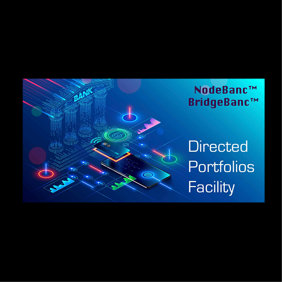
Digital Medallions™ – Each activated Pad requires a corresponding Digital Medallion to govern rights of use, priority access, and revenue sharing. These Medallions are digitally recorded, issued by the Authority, and tradeable under protocols established in the Digital Tariff Government Authority.
Single-Payment Long-Term Leases – Where appropriate, the Authority may offer land under long-term prepaid leases (e.g., 99-year single-payment leases), creating upfront capitalization to fund development and site activation while avoiding private business use triggers.
Tax-Exempt Municipal Bonds – The Authority may issue tax-exempt municipal revenue bonds for:
Land acquisition
Site preparation
Infrastructure installation
Public asset improvement
These are carefully structured to avoid violating IRS regulations concerning private activity.
Land acquisition financed with tax-exempt bonds is typically kept under public-purpose control or leased under conditions compliant with IRS safe harbors.
Navigating IRS Safe Harbors: Minimizing Private Business Use
In the traditional port authority model, land leased to private parties can constitute “private business use,” potentially disqualifying bonds from tax-exempt status. To address this, the O|Zone Authority adheres to a structure in which:
Private users (e.g., developers, pod operators, medallion holders) are framed as Sub-Concessionaires under a Master Concessionaire agreement, preserving the Authority’s control over site policy and operations.
Tariffs and medallions serve as revenue mechanisms without granting direct ownership or long-term private leases on bond-financed land.
Any private use is carefully tracked to remain below the 10% threshold under IRS Section 141(b).
Where necessary, private-use parcels may be segregated and financed through non-tax-exempt mechanisms, or structured using prepaid lease models to preserve flexibility while maintaining compliance.
Interconnected Sites, Unified Governance
Even though O|Zone Sites may be spread across the county, they are governed as part of a single digital framework. Each site enters the system through:
Site designation by the Authority
Digital Land Library registration
Medallion assignment
Tariff mapping and operational policy
This ensures uniform governance while allowing differentiated use cases. What binds these distributed nodes is the economic engine and protocol suite created by the Authority: tariffs, medallions, leases, and municipal bond-financed infrastructure.
Preparing for Developers
With this financial architecture in place, the stage is set for private-sector Developers to enter as Sub-Concessionaires. Their role is not simply to build—it is to activate sites and pads in a manner consistent with the Authority’s protocols, revenue model, and public benefit mandate.
The next section explores how Developers operate within this Distributed Port Model—whether converting parcels to sites, preparing pads for advanced pod installations, or generating long-term infrastructure value while participating in the digital tariff ecosystem.
From Parcel to Site to Pad: Developer-Catalyzed Land Conversion
While the Land Inputs framework enables the Authority to acquire parcels of land through various means, the true value of that land is only unlocked through conversion.
Within the O|Zone™ framework, land exists in three progressive states:
Parcel — a raw piece of land as defined by existing legal boundaries, often unprepared for infrastructure, renovation or economic activity.
Site — a designated portion of land that has been reviewed, mapped, and approved by the O|Zone™ Government Authority for potential activation.
Pad — a pad-ready, infrastructure-supported, permitted location cleared for immediate use by a Sub-Concessionaire, public facility, or innovation operator.
This transformation—from parcel to site to pad—is not automatic. It requires human initiative, capital, design, and technical expertise.
For this reason, the Authority’s land activation strategy includes a distinct role for Developers operating as designated Sub-Concessionaires under the Master Concessionaire.
Developer as Catalyst
A Developer may engage at any stage of this conversion process:
Parcel Focus: Identifying and proposing underutilized or legacy parcels for acquisition or leaseback under the Authority.
Site Formation: Bundling multiple parcels, or requesting site designation of a single parcel, following technical review, digital mapping, and due diligence.
Pad Conversion: Transforming sites into pad-ready infrastructure zones—including grading, drainage, access roads, and utility planning—pursuant to site-specific objectives (e.g. ScanPort™, La Trattoria™, GreenBox™).
In each role, the Developer operates as a catalyst—not simply a builder, but a site strategist and integrator, aligning public infrastructure, regulatory conditions, and private enterprise interests.
Entry into the O|Zone™ Program
Developers may also propose:
Entry of Existing Parcels into the O|Zone™ program, if the Developer has secured options, leases, or ownership of eligible land.
Re-designation or Subdivision of previously approved sites into more focused pads tailored for high-value use cases.
Regulatory or Title Curation of difficult parcels to clear the way for inclusion—remediating title defects, proposing ring-fenced structures, or enabling temporary concessions.
Feedback Loop into the Digital Land Library
All Developer proposals and activities feed back into the Digital Land Library, enriching the Authority’s AI-assisted understanding of land availability, opportunity, and risk. Developers who uncover key documents, site histories, or environmental data contribute to the living archive, enhancing future decision-making.
Interoperability with Other Authorities
Where applicable, the Developer may coordinate land preparation with other Government Authorities (e.g. O|Zone Energy & Power, Water & Waste) to:
Extend infrastructure
Secure easements
Map tariff zones
Ensure pad interoperability with future facilities
In this way, Developers become not only builders, but integrated ecosystem participants, accelerating land-to-utility-to-activation pipelines across the county.
Stewardship Through Time: The Developer as Godparent
Beyond the technical conversion of parcels into active pads, the Developer assumes a deeper role—as godparent to the land itself. This stewardship function is not limited to the construction phase, but extends across years, and in many cases, decades. Developers may remain involved through lease administration, medallion tracking, environmental monitoring, performance measurement, and reinvestment cycles.
Their long-term orientation—anchored in local knowledge, private capital, and public trust—enables continuity of site development in ways that transient contractors cannot offer. In counties where generational neglect, fractured title, or structural decay has inhibited progress, the Developer-godparent becomes a trusted agent of renewal: a quiet partner ensuring that land, once brought into the framework, is not just activated once, but shepherded through cycles of adaptive reuse, cross-authority coordination, and economic rebirth.
O|Zone Government Authority is the land steward of the Initiative. It holds, leases, and improves parcels to make Opportunity Sites possible—issuing Digital Medallions tied to approved land uses. Though independent from the O|Zone Digital Tariff Authority, it connects through shared protocols, enabling digital tariffs and medallion activity to be anchored in physical land. Each does its part. Neither governs the other.

O|Zone Government Authority is more than a mechanism for development—it is a long-term guardian of land use, economic vitality, and digital intelligence. By aligning international best practices with county-level leadership and advanced digital tools, it ensures that every parcel entering the system is not just processed, but understood; not just activated, but cared for across generations. With its embedded structures for zoning, tariffs, medallions, and community partnerships, the Authority provides a foundation for public trust and private innovation to thrive together—site by site, pad by pad, future by future.
Additional appendices and implementation guides available upon request